


Fort Anne National Historic Site of Canada
295 St. George Street, Fort Anne National Historic Site, Annapolis Royal, Nova Scotia, B0S 1A0, Canada
Formally Recognized: 1920/01/30
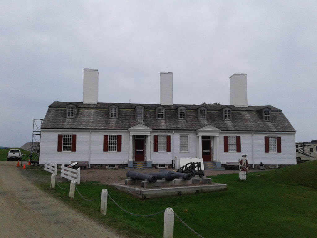
Front Facade, 2017
General View, 2017

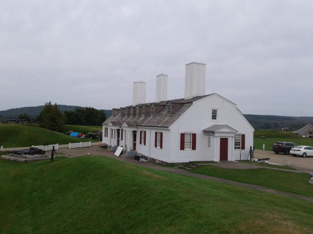
Side Facade, 2017

Panorama

General View

General View
Other Name(s)
Fort Anne National Historic Site of Canada
Fort Anne
Links and Documents
Construction Date(s)
1629/01/01 to 1799/01/01
Listed on the Canadian Register: 2005/03/16
Statement of Significance
Description of Historic Place
Fort Anne National Historic Site is a fortified site located at the confluence of the Annapolis and Allain rivers in the town of Annapolis Royal. Settled since 1629, the fort consists of the remains of various 18th and 19th century buildings and fortifications, the land surrounding them, and viewplanes over the adjacent salt marshes, river and town. Specific resources include the powder magazine (1708); the remains of a Vauban-style French fort (1702-8) with an underground powder magazine, a parade square well, a covert way well and earthworks; a dry-stone retaining wall (1760); a 19th-century Sally-port; shoreline cribwork (1740s); the ruins of the Queen’s wharf (1740s); the British Officers’ quarters (built 1797-9 and reconstructed 1934-5); an Acadian cemetery; and a British garrison cemetery.Heritage Value
Fort Anne National Historic Site is of national historic significance because of the site’s role in early European colonization, settlement and government in Acadie and Nova Scotia in the 17th and 18th centuries; in the struggle for empire in the 17th and 18th centuries; as the centre of changing social, political and military relations among the Mi’kmaq, the Acadians and the British living in the area throughout the 17th and 18th centuries; and as an example of Vauban-style fortifications that survive due largely to successive generations of Canadians who treasure their cultural landscapes.The site was the location of Charles Fort, settled in 1629-32 by settlers led by Sir William Alexander as part of his plan for a New Scotland. Charles de Menou D’Aulnay brought Acadian settlers to the area in 1636, making the site his Port-Royal headquarters. Acadians began their distinctive dykeland agriculture here. The French governed Acadie from successive forts on the site until 1710. From 1713 to 1749, the British governed Nova Scotia from the fort, re-named Annapolis Royal. The Deportation of the Acadians from Annapolis Royal, and the settlement of New England Planters and of Loyalists were all organized from the site during the 18th century.
As the capital and military centre of Acadie/Nova Scotia, the site played an important role for local inhabitants. The Mi’kmaq came to the site to trade, to take part in gift exchanges and to sign treaties. During the “Indian Wars” of the 1720s, they were imprisoned here.
Port-Royal and its successive forts were a focal point in the imperial struggle for control of North America. With each outbreak of war between England and France, New England launched expeditions against Port-Royal, capturing it in 1654, 1690 and, for the final time, in 1710. During the War of the Austrian Succession (1744-8), Quebec and Louisbourg sent unsuccessful expeditions to retake the fort.
Fort Anne is a classic Vauban fort, designed and built by an engineer who had studied under European fort designer Sebastian LePrestre de Vauban. Local residents began to preserve the fortifications, with the help of the federal government, as early as the late-19th century. In 1917 it was declared a Dominion Park, Canada’s first administered national historic site.
Source: Historic Sites and Monuments Board of Canada, Minute, 1994; Commemorative Integrity Statement.
Character-defining Elements
The key elements that relate to the heritage value of Fort Anne are:- surviving remnants of the original officers’ quarters, namely the footprint and form of the building, and the original fireplaces;
- the powder magazine (1708), including its siting within the fort, its design, and its original masonry;
- remnants of the Vauban fort (1702-8), including the underground powder magazine of the west bastion, the parade square well, the covert way well, the earthworks and other parts of the fortifications;
- the dry-stone retaining wall (1760) opposite the east bastion;
- the Sally-port, constructed in the 19th century in the location of the Sally-port of the Vauban fort;
- the shoreline cribwork (1740s), built to mitigate shoreline erosion and reflecting 18th-century technology;
- the Queen’s wharf ruins (1740s), the only visible remains of the 1740 structures that stood outside the ramparts on the waterfront area, reflecting technology from the mid-18th to the early-20th century;
- the cemeteries, dating from early Acadian and British settlement, including gravestones and the early-19th-century, cast-iron fence;
- viewplanes on the Annapolis River, Annapolis Basin and the town of Annapolis Royal.
Recognition
Jurisdiction
Federal
Recognition Authority
Government of Canada
Recognition Statute
Historic Sites and Monuments Act
Recognition Type
National Historic Site of Canada
Recognition Date
1920/01/30
Historical Information
Significant Date(s)
1695/01/01 to 1708/01/01
Theme - Category and Type
Governing Canada
Government and Institutions
Governing Canada
Military and Defence
Function - Category and Type
Current
Leisure
Historic or Interpretive Site
Historic
Defence
Military Defence Installation
Architect / Designer
N/A
Builder
N/A
Additional Information
Location of Supporting Documentation
National Historic Sites Directorate, Documentation Centre, 5th Floor, Room 89, 25 Eddy Street, Gatineau, Quebec
FED/PROV/TERR Identifier
254
